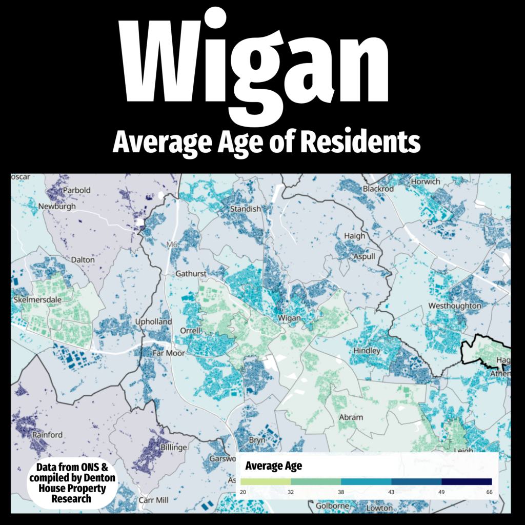
Understanding the average age of residents across different council wards in of Wigan and the surrounding areas, is both interesting and crucial for both current residents, landlords plus prospective tenants and homebuyers.
This heat map, compiled using data from the Office for National Statistics and Denton House Property Research, provides a visual representation of the demographic distribution throughout our town and the surrounding areas.

For residents, this information can foster a deeper connection to their community by highlighting areas with similar age groups, potentially enhancing social cohesion and community engagement. Additionally, local Wigan businesses can tailor their services and products to meet the needs of predominant age groups, thereby enhancing customer satisfaction and business growth.
For prospective Wigan homebuyers, understanding the average age of residents can significantly influence their decision-making process. Families with young children might prefer neighbourhoods with other young families, creating opportunities for social interaction and community building. Conversely, retirees might seek areas with a higher concentration of similarly aged residents, ensuring a quieter and more relaxed environment.
As an estate & lettings agent in Wigan leveraging this detailed demographic data enables us to offer tailored advice and guidance to our clients, ensuring they find the perfect neighbourhood that aligns with their lifestyle and preferences. This map is a valuable tool for anyone looking to make informed decisions about where to live in Wigan,
If you would like to chat about your property needs, whether you are buying or selling, speak to our team of local professionals.


